


Vernon Voting District, Windham County, Vermont
About
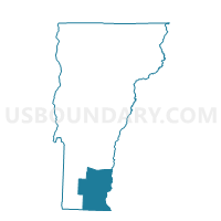
Outline

Summary
| Unique Area Identifier | 680940 |
| Name | Vernon Voting District |
| County | Windham County |
| State | Vermont |
| Area (square miles) | 20.06 |
| Land Area (square miles) | 19.45 |
| Water Area (square miles) | 0.62 |
| % of Land Area | 96.93 |
| % of Water Area | 3.07 |
| Latitude of the Internal Point | 42.76413290 |
| Longtitude of the Internal Point | -72.52208620 |
Maps


Graphs
Select a template below for downloading or customizing gragh for Vernon Voting District, Windham County, Vermont


Neighbors
Neighoring Voting District (by Name) Neighboring Voting District on the Map
- Bernardston Precinct 1, Franklin County, MA
- Brattleboro District 2 Voting District, Windham County, VT
- Guilford Voting District, Windham County, VT
- Northfield Precinct 1, Franklin County, MA
- TOWN OF HINSDALE Voting District, Cheshire County, NH
Top 10 Neighboring County Subdivision (by Population) Neighboring County Subdivision on the Map
- Brattleboro town, Windham County, VT (12,046)
- Hinsdale town, Cheshire County, NH (4,046)
- Northfield town, Franklin County, MA (3,032)
- Vernon town, Windham County, VT (2,206)
- Bernardston town, Franklin County, MA (2,129)
- Guilford town, Windham County, VT (2,121)
Top 10 Neighboring Elementary School District (by Population) Neighboring Elementary School District on the Map
- Brattleboro School District, VT (12,046)
- Vernon School District, VT (2,206)
- Guilford School District, VT (2,121)
Top 10 Neighboring Secondary School District (by Population) Neighboring Secondary School District on the Map
Top 10 Neighboring Unified School District (by Population) Neighboring Unified School District on the Map
Top 10 Neighboring State Legislative District Lower Chamber (by Population) Neighboring State Legislative District Lower Chamber on the Map
- Second Berkshire District, MA (40,125)
- State House District 4, Cheshire County, NH (11,991)
- Windham-1 State House District, VT (4,327)
- Windham-3-2 State House District, VT (3,922)
Top 10 Neighboring State Legislative District Upper Chamber (by Population) Neighboring State Legislative District Upper Chamber on the Map
- Hampshire & Franklin District, MA (156,938)
- State Senate District 10, NH (52,718)
- Windham State Senate District, VT (42,637)
Top 10 Neighboring 111th Congressional District (by Population) Neighboring 111th Congressional District on the Map
- Congressional District 2, NH (658,486)
- Congressional District 1, MA (644,956)
- Congressional District (at Large), VT (625,741)
Top 10 Neighboring Census Tract (by Population) Neighboring Census Tract on the Map
- Census Tract 9685, Windham County, VT (5,807)
- Census Tract 402, Franklin County, MA (4,340)
- Census Tract 9687, Windham County, VT (4,327)
- Census Tract 9716, Cheshire County, NH (4,046)
- Census Tract 403, Franklin County, MA (3,032)